 When I made plans to lunch with a friend in an unfamiliar town, I had to look at a map to get my bearings and noticed a forest preserve nearby. Always up for an adventure, I decided to take a little walk after meeting my friend and made sure to bring my waterproof hiking boots.
I drove into the ice-laced parking lot and watched a burly male hiker enter the trailhead. After lacing up my boots, donning a winter headband, wrapping a scarf around my neck, and putting on knit gloves, I was ready to begin. I tromped through the snow to a sign depicting a large blue lake, expecting to see trail map, but it was merely a bit of history. The trail probably follows the lake, I thought.
 At first it did, curving around the snow-covered expanse of the lake’s frozen surface. But then the trail split away and I wasn’t sure if I should forge my own path, keeping the lake in view, or follow the fresh footprints of the man I had seen taking the same route. Surely he was circling the lake, too. Following him made sense, since the lake’s edge might be pocked with holes hidden by the snow.
I came to a double sign and was sure one of the stacked boards would steer me in the right direction, but any paint had long worn off. The front and back of the weathered wood signs looked identical.
I found myself approaching a small abandoned building, which turned out to be an old latrine—three seats across—carved out of wood. The shoe treads of the man were now gone, and in their place were tiny squirrel and raccoon prints. He must have turned back and I didn’t notice.
The path divided again and again until I reached an open area that allowed me to see quite far. I saw no lake. I did spot a blotch of white among a stand of dark trees in the distance. As I squinted, it was suddenly aloft beating massive wings—a snowy owl?
 The sun was traveling quickly to the west. Evenings come early this time of year and I didn’t want to be lost in the dark. That’s when I realized the smartphone I was taking pictures with also had a Global Positioning System. Perhaps I could navigate my way back via satellite.
I turned on the map and voila, I was a blue dot among a crisscross of trails, and I had been traveling farther and farther away from my car—not around the lake. In fact, there was no trail encircling the lake. I felt giddy as I tried different paths and could quickly identify if I had chosen the right one. Knowing how to get back gave me the freedom to enjoy the forest’s marvels. Now I could calmly remember that the golden green moss I photographed against a snowy tree trunk indicated north. I could even appreciate the setting sun, knowing I was close to the parking lot.
No matter how many twists and turns I take on my life’s journey, I’m bound to find my way home. Learning to navigate the path and noticing the wonders along the way is half the fun.
 All photos © Sondra Sula.

 Ravens sing—are you listening? On Summers Lane, rain is glistening. It’s a lovely sight (and I’m happy all right) walking in this “winter” wonderland.
 In the meadow blackberries begin to bloom. It’s not pretend that spring is on the way. You might say: Are you kidding me? But I’ll say: No, it’s true in this town.
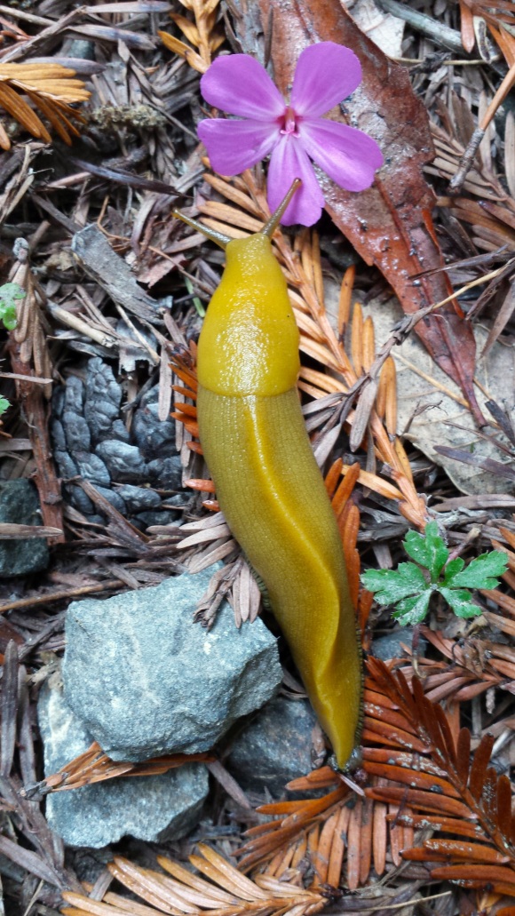 In the forest I can build a tree house, or just a spot to sit and meditate. I’ll enjoy the richness of the air, and if I’m looking might just see a slug.
 All photos © Sondra Sula.
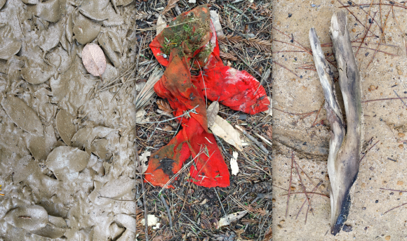 Winter on the Mendocino coast is unlike any previous winter I’ve experienced. Blankets of snow are replaced by buckets of rain, and slippery ice by slick mud. Temperatures hover above freezing rather than below, so litter is never swept under the rug of pristine white snowflakes until spring.
 A trinity of leaves strewn over the pygmy-poor sand overlap, like family. One is heart-shaped and facing down so that its back veins protrude, forming a miniature tree.
 I pass what I presume to be car parts. I am mesmerized by the way four compartments hold water and forest detritus in a rusted engine block as if this were their intended function. The inner workings of a wheel appear to be a clock telling of timelessness.
 A pale greenish yellow plastic disc hidden in grass emits a yo-yo-like charm. Even though it is most likely the wheel off a cart, it reminds me how children, when unwrapping presents, often play with the boxes. How they can make dolls out of hollyhock flowers, clothespins or corn husks.
 I am offered more presents as I round a bend: a halved pine cone, an axe-chewed bough—its tip an orange flame, a wooden crown fashioned by termites.
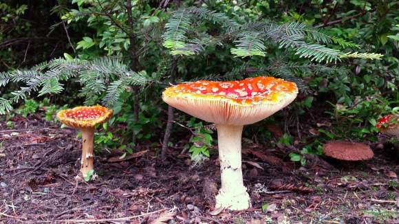 My final gifts stand under a small redwood whose needled arms hover as if in blessing. They are fairy-tale mushrooms, otherwise known as amanita muscaria, packaged in brilliant red studded with white. Their graceful gills rise upward to receive their blessing. I, too, have received mine.
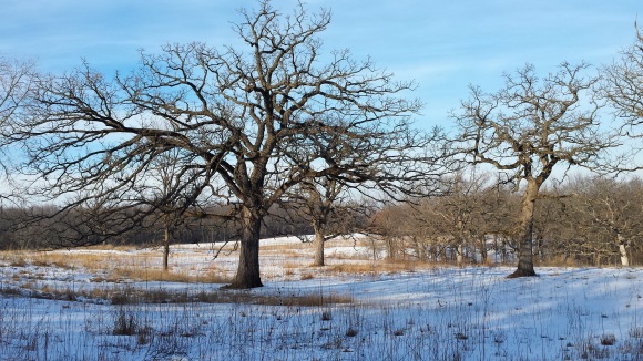
 Close to the Ides of March, when the winter snow melts in Aurora, Illinois, a drab landscape unfolds in shades of brown and gray. A feeling of impatience wells up within me to experience the brightness of spring, with her wildly colored tresses and riot of movement.
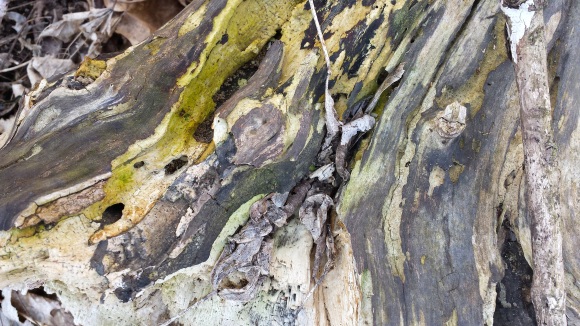
 But if I am patient, and look closely at the forest before me, I spot signs of life. A dead log thrills my sense of design with its abstract patterns of ivory, chartreuse and silver created by living decay. Oak leaves shimmer with diseased spots that look radiant against the monochromatic forest floor. A tiny spider catches my eye, and I snap a photo of him before he jumps away. What else can I find?
 I behold a glorious display of snowdrops—triune petticoats aflutter in the strong breeze—that have pushed through a season’s worth of heavy mulch despite their delicate appearance. Nearby a tiny caterpillar crawls quickly, his dotted yellow sides undulating with every parallel movement of his suction-cup legs. I even see a green-leaved vine snaking its way up the rough bark of a tree.
 All photos © Sondra Sula.

 Snow drifts down from the sky like shaved coconut, sweetening the landscape with its whiteness. I pass a melted spot along an asphalt portion of the path—a circle scattered with freshly cut wood chips. Its dark eye stares at me and I stare back, noting its conglomerate composition, which is made of many different stones joined together.
 Snowflakes are falling individually and slowly; I can capture their shapes in the lens of my camera. One flake looks like six fir trees laid flat and merged into a single trunk. Another looks like a brittle star floating in an ocean sky. An X-shaped snow crystal begs the question: Is it missing two “limbs” or is it fully formed?
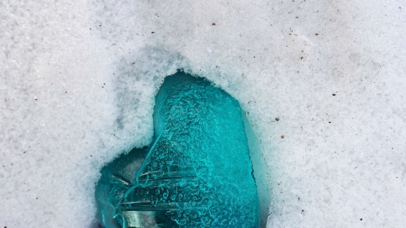 Finally I see a tuft of grass—bright green as if unaware of winter. The snow and ice have created a protective coating around the small outcrop keeping the blades pliable and nourished.
 All photos © Sondra Sula.
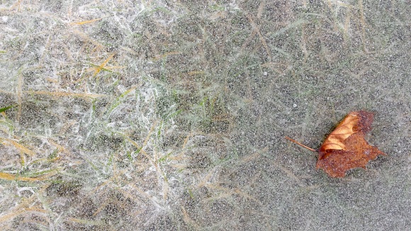 The theme of my walk repeated itself over and over: entombment. Bits of grass, leaves, sticks, even papers are trapped beneath a layer of ice.
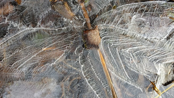 At first this feels stifling, suffocating—but then I begin to notice that each item is breaking free. The maple leaf’s edge is flapping in the fierce wind. A stick creating the body of what appears to be an ice dragonfly is protruding from the clear, crystalline surface. Ochre and green blades of grass are thrusting their swords through tiny openings in the frozen water. And even the thick, yellowish paper pokes its corner through milky, hazy ice.
 I realize that when I think I’m stuck, I’m actually being held by God. I am not ready for what lies ahead—not yet. Part of me pushes on, exposed, flailing out into the elements. But Wisdom bids me wait until the sun warms me, until breaking out of my entombment does not harm me. When the ice melts, every part of me is ready to move on, unencumbered.
 All photos © Sondra Sula.
 Near the North Aurora dam there is a big crack in the ice. The crack extends out from the east edge, cutting a diagonal line that ends mid-river, at the mouth of the dam. Water from underneath the ice flows down and over the shallow dam. This crack creates a large triangle, about two hundred feet on its longest side.
 I imagine this triangle, this massive chunk of ice, cracking off. How exciting and frightening it would be to see it come crashing down the tiny falls, breaking into smaller pieces. I imagine the noise, the piercing cracks, the pushing of air from the wings of surprised mallards, geese, and herons, and the immense splashes of solid hitting liquid. All of this would take place rather quickly and then things would gradually go back to the way they were.
 Sometime in our lives, we are living with a crack. We’re so afraid of a part of us breaking off and flowing down the river. We’re afraid of the repercussions, of getting hurt, of hurting others. But God is with us. Even when the piece breaks off. Even as we gradually get back to whom we once were. Even if we’ve changed and that triangle of us is forever gone, God remains with us.